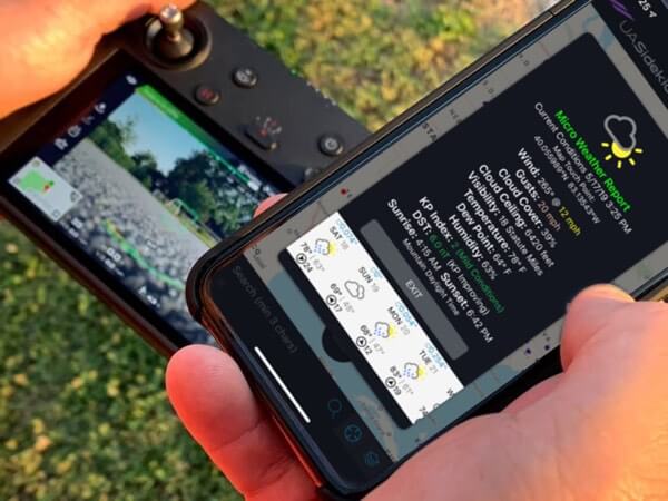
Make the right call in every weather condition. Plan safe routes and complete your mission.
About
UASidekick is an app company for drone operators providing near instantaneous airspace authorizations and flight planning safety tools. It has the goal to bring all members of the aviation community (both manned and unmanned) onto one common platform to improve safety, transparency, and communication. With goals to successfully grow the drone industry, the app streamlines processes and eases the workload associated with many of the necessary tasks of flying. UASidekick provides functionalities such as: airspace awareness, flight logging, and LAANC-NOTAM-UOA flight filing in only 30 seconds.
Due to UASidekick’s unique ability to provide better safety and improve associated insurance loss ratios, Allianz Global Insurance and Transport Risk Management offer 25% off market insurance rates to the app’s users. Additionally, UASidekick collaborates with a nonprofit organization called the Coalition of UAS Professionals.
Challenge
Solution

Traditional weather companies repackage the same government data and models. ClimaCell sees the world differently and turns everything around us-from windshield wipers to cellular towers-into virtual weather sensors feeding proprietary weather models. ClimaCell produces accurate, actionable, minute-by-minute, street-by-street forecasting that provides operators with drone specific weather. ClimaCell’s low-altitude, real-time forecasts help drones dodge bad weather and make the right risk calculations to maximize safe flying time ahead of bad weather. The result is a MicroWeather API with the most accurate, comprehensive, and up-close view of the weather available to include in UASidekick’s real-time integrated FAA Flight Service System app:
- Precipitation intensity and type
- Visual layers of wind (speed/direction/gust) Cloud base height
- Low-altitude (< 400ft), real-time forecasts for drones – minute-by-minute, street-by-street
Benefits
Safety
UASidekick’s users can now make calculated weather decisions to increase safety and mission success by leveraging ClimaCell’s low-altitude, real-time forecasts for drones.
- Drone pilots are able to protect their assets by avoiding bad weather like rain, snow, and wind gusts.
- Providing the height of cloud bases increases the drone pilot’s ability to ensure the distance and safety between manned and unmanned aircraft.
Route Planning
When planning flight routes, UASidekick’s users can use ClimaCell’s forecasting, from real-time to two weeks out, to proactively factor in weather conditions along the flight path. Accurate MicroWeather forecasting allows drone pilots to make calculated and safe mission schedules-preventing them from wasting valuable time and money by driving to a site and having an unsuccessful mission due to bad weather.
Operational Efficiency
UASidekick’s users can use accurate weather forecasting to optimize drone operations.
- Knowing the best time to fly and not fly, allows commercial drone businesses to take advantage of as many jobs possible and maximize revenue.
- Accurate drone-specific weather forecasts enable firefighters and police officers to immediately deploy drones at the site of an emergency.


